

Listing Courtesy of: Coeur D'Alene MLS / Century 21 Beutler & Associates / Sarah Scott
16443 W Sala Lane Hauser, ID 83854
Active (367 Days)
$995,000 (USD)

Description
MLS #:
25-2917
25-2917
Taxes
$2,340(2024)
$2,340(2024)
Lot Size
18.23 acres
18.23 acres
Type
Land
Land
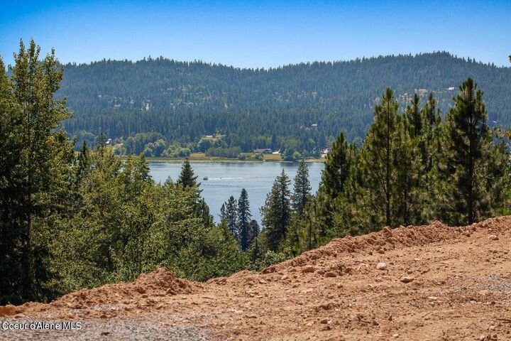
Views
Lake, Mountain(s)
Lake, Mountain(s)
School District
Lakeland - 272
Lakeland - 272
County
Kootenai County
Kootenai County
Community
N/a
N/a
Listed By
Sarah Scott, Century 21 Beutler & Associates
Source
Coeur D'Alene MLS
Last checked Apr 3 2026 at 4:47 PM GMT+0000
Coeur D'Alene MLS
Last checked Apr 3 2026 at 4:47 PM GMT+0000
Bathroom Details
Subdivision
- N/A
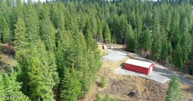
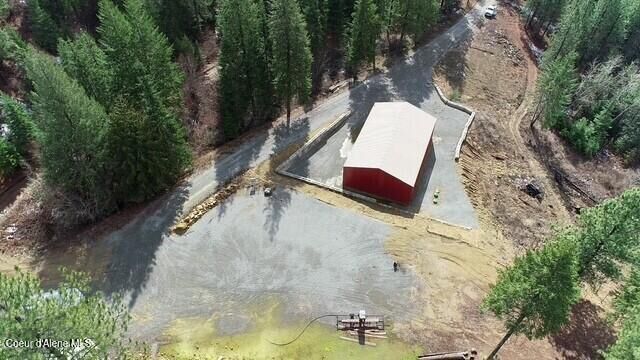
Lot Information
- Sloped
- Wooded
Exterior Features
- See Remarks
Utility Information
- Sewer: Septic Tank
Location
Estimated Monthly Mortgage Payment
*Based on Fixed Interest Rate withe a 30 year term, principal and interest only
Listing price
Down payment
%
Interest rate
%Mortgage calculator estimates are provided by C21 Beutler & Associates and are intended for information use only. Your payments may be higher or lower and all loans are subject to credit approval.
Disclaimer: IDX information is provided by the Coeur d’Alene Multiple Listing Service exclusively for consumers’ personal, non-commercial use, that it may not be used for any purpose other than to identify prospective properties consumers may be interested in purchasing. Data is deemed reliable but is not guaranteed accurate by the MLS. Data last updated: 4/3/26 09:47


PROPERTY BOUNDARY NOTES:
1) The SOUTHWEST corner survey pin is located left of the 16433 driveway entrance; flagged; signs denote the location.
>From this pin, the SOUTH property boundary is uphill to the right.
>From this pin (along the dirt road to the left) is the southern portion of the WEST property boundary; uphill; marked with signs and flagging.
2) The NORTHWEST corner survey pin is located uphill on the left side of the build pad site, marked with blue & pink tape, approximately 50' into the trees; a sign denotes the location.
> From this pin, the NORTH property boundary runs to the right & uphill with intermittent stakes flagging the approximate property line.
> From this pin, the northern half of the WEST property boundary is viewed adjacent to the build pad and shop, marked with signs & flagging.
> Adjoining acreage available (from a neighbor) along this northern-west property boundary, to own the visible land, & widen the property if desired.
> From the build pad site, a dirt road located east of the driveway, leads to the SOUTH EAST property boundary & driveway to 16431.
3) The EAST property boundary can be viewed from the top of the 16431. Permission to drive through to view needed.
BUILD PAD UTILITIES:
> Electric panel at the corner near driveway. 200 amp electric with 30 & 50 amp plug ins.
> Septic connection (covered by an orange cone) located in front of the electrical panel.
> Water on/off valve is below ground. Access is capped with black ABS pipe, located in front of the electrical panel & to the right of the Frost-Free hose connection.